National Environmental Satellite, Data, and Information Service (NESDIS)
In response to the growing threat of wildland fires to local communities, the National Oceanic and Atmospheric Administration (NOAA)’s National Environmental Satellite, Data, and Information Service (NESDIS) have developed a new Wildland Fire Data Portal, which provides open access to the experimental products from the Next Generation Fire System (NGFS). The NGFS uses a sophisticated algorithm that automatically identifies heat anomalies in Geostationary Operational Environmental Satellite (GOES) satellite data, even through clouds and smoke. GOES is a collaborative NOAA and NASA program providing continuous imagery and data on atmospheric conditions and solar activity (space weather).
Early success of AI-powered fire detection system is winning fans in firefighting community
This NGFS has been embraced by the firefighting community and is being increasingly integrated into operations across the country.
The two key features are the Advanced Baseline Imager on satellites and the NGFS algorithms that continuously analyze enormous volumes of data to identify heat anomalies. The satellites can detect fires as small as 1 acre.
In a fire in Oklahoma, state officials said that GOES satellites provided initial detection on 19 separate fires, resulting in fire spread modeling the saved more than $850 million dollars—250 times the cost of developing the system.
CLICK HERE to read the full article.
CLICK HERE to view the NESDIS Beta Wildland Fire Data Portal. (Note: This is still in Beta and best viewed on a computer. Click on the “Dismiss” on the pop-up button, and play with the sliders to review the tracking ability.)
Although Fire History still plays an important part, Wildfire Mitigation today, at both the tactical and insurance levels, focuses on future prediction through modeling.
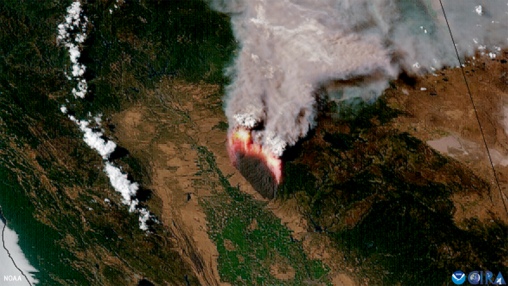
An image of California’s Park Fire and smoke taken from space by NOAA’s GOES-18 satellite on July 26, 2024.
(Image credit: NOAA Satellites)
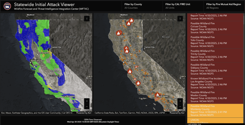
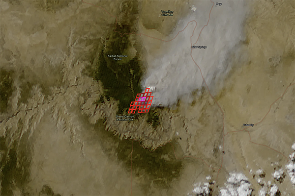
Multiple potential wildfire starts in California detected by NOAA’s Next Generation Fire System on April 30, 2025, are displayed on this California Office of Emergency Services dashboard.
(Image credit: Courtesy of California Office of Emergency Services)