The Center for Geospatial Science and Technology (CGST) at California State University, Northridge, is an interdisciplinary research center dedicated to advancing the use of Geographic Information Systems (GIS) for real-world problem-solving, education, and innovative applications. GIS is a powerful digital tool that enables storage, visualization, and analysis of geographic data.
In 2023, recognizing the importance of creating defensible space by clearing wildfire fuel for wildfire mitigation and community resilience, CGST teamed up with the Oak Park Fire Safe Council (OPFSC) on a key project to develop a defensible space map for Oak Park.
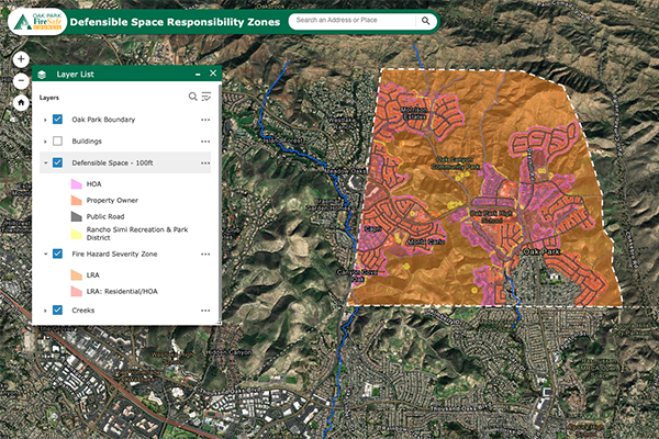
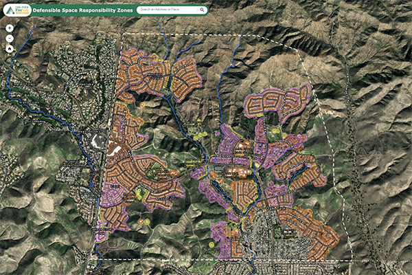
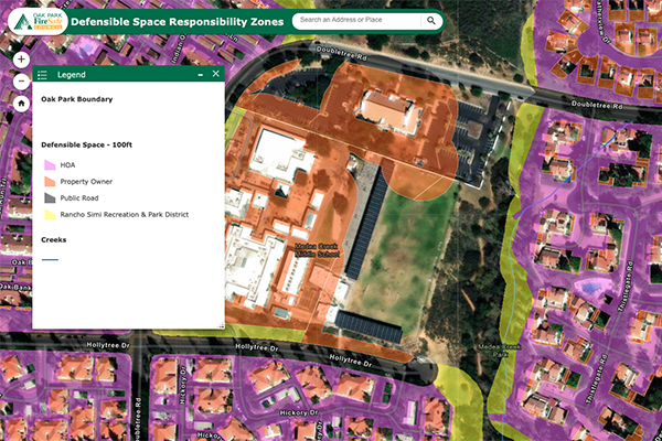
This collaboration resulted in the creation of the Defensible Space Responsibility Zones interactive web map which provides Oak Park residents with an effective and user-friendly way to engage with defensible space information. This publicly accessible tool displays the 100-foot defensible space zones and identifies the entity (individual homeowners, homeowners’ associations (HOAs), or the Rancho Simi Recreation and Park District) responsible for the defensible space. The map also allows users to view acreage of defensible space for a given property, perform measurements (both linear and areal), print custom maps, and more.
CGST and OPFSC are actively exploring opportunities for future initiatives that would provide additional resources to enhance wildfire resilience and build upon the success of the initial project.